
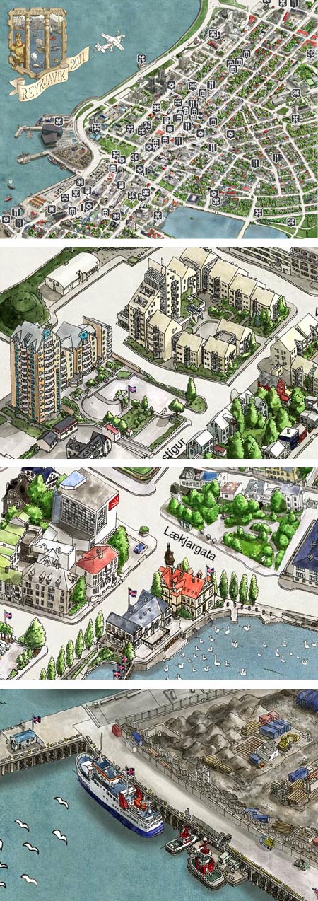
The interactive Reykjavík Center Map, which at first glance might appear to be a Google Earth style map with computer modeled buildings in isometric perspective, is in fact a hand-illustrated image, apparently in pen and ink and watercolor.
I can’t find specific credits for the art, but one of the team who worked on the map said it took over two years and 3,000 hours to create.
Beautifully done, with wonderful little touches of detail and local texture, the map can be zoomed in on to appreciate the drawings.
Oh yes, you can also use it to find your way around the center of Iceland’s capital, along with places to eat, sites to visit and stores to buy your Sugarcubes CDs.
[Via The Map Room by way of MetaFilter]
[Addendum: Snorri Þór Tryggvason was kind enough to write (see this post’s comments) and let us know that he and a group of friends are the creators of the map. They are architects and go collectively by the name of “Borgarmynd” (“City-Image”). He points out that their names are scattered throughout the map (one more fun thing to look for).]